UK taxes included where applicable. Export prices are excluding VAT.
Shipping calculated at checkout.
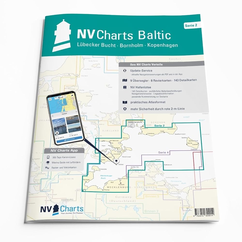
The NV Atlas Germany DE 2 – Lübecker Bucht to Bornholm and Copenhagen is a specialized chart set for sports and cruising vessels on the Baltic Sea. It combines clear cartography with practical detail for safe route planning.
Coverage: Lübecker Bucht, Mecklenburg coast, via Rügen to Bornholm, South Sweden, Malmö, Copenhagen and back via Møn, Falster, Lolland and Fehmarn
Multiple scales with sea charts, harbor plans and detailed approach charts
Includes bridge clearances, overhead cable heights and other key navigational data
Logical, easy-to-read layout for fast identification of fairways, harbors and anchorages
Designed specifically for recreational boating with balanced sheet cuts and practical formats
An essential chart pack for Baltic sailors exploring Germany, Denmark and Sweden.