UK taxes included where applicable. Export prices are excluding VAT.
Shipping calculated at checkout.
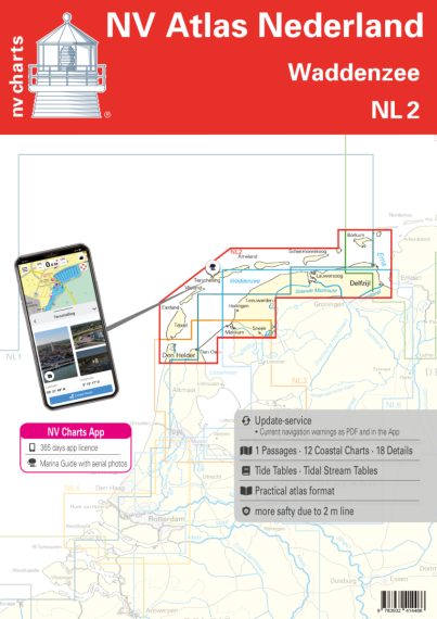
Navigate the Dutch Waddenzee with confidence using the NV Atlas Nederland NL 2 nautical chart set, optimised for demanding tidal waters from Borkum to Den Helder.
Coverage: Wadden Sea islands (Schiermonnikoog, Ameland, Terschelling, Vlieland, Texel) plus coast from Ems estuary to IJsselmeer
Chart package: 1 oversailer, 11 district charts, 17 detail charts, harbour plans and tidal calendar
Format: Robust atlas in splash‑protected cover with flat binding for easy course plotting
Digital access: 365‑day licence for NV Charts app (iOS, Android, PC, Mac) with offline use and regular updates
Ideal as the main paper chart set for safe cruising in the Waddenzee.