UK taxes included where applicable. Export prices are excluding VAT.
Shipping calculated at checkout.
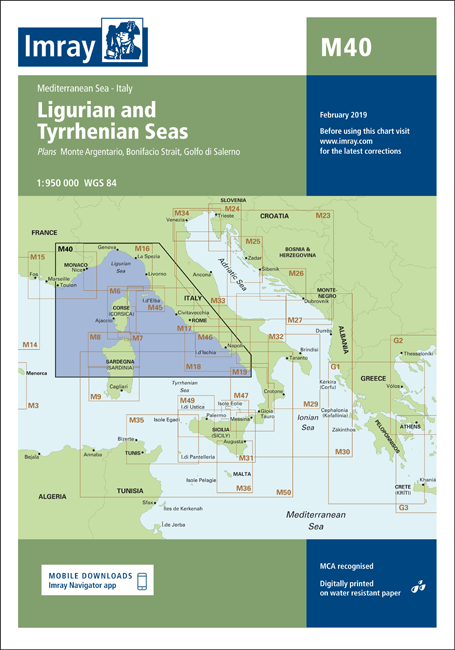
Navigate the western coast of Italy with the Imray M40 Ligurian and Tyrrhenian Seas nautical chart, covering key cruising grounds from Liguria to the Tyrrhenian Sea. Designed for coastal passages and offshore routing.
Coverage: Ligurian and Tyrrhenian Seas with strategic focus on Monte Argentario, Bonifacio Strait and Golfo di Salerno
Detailed plans: Monte Argentario (1:100 000), Bonifacio Strait (1:225 000), Golfo di Salerno (1:100 000) for detailed pilotage
Updates: 2014 edition with revised depths and latest hydrographic information for reliable route planning
AIS information: Recently deployed AIS transmitter locations shown to aid traffic awareness
Harbour detail: New marina in Rada di Salerno clearly indicated for berth planning