UK taxes included where applicable. Export prices are excluding VAT.
Shipping calculated at checkout.
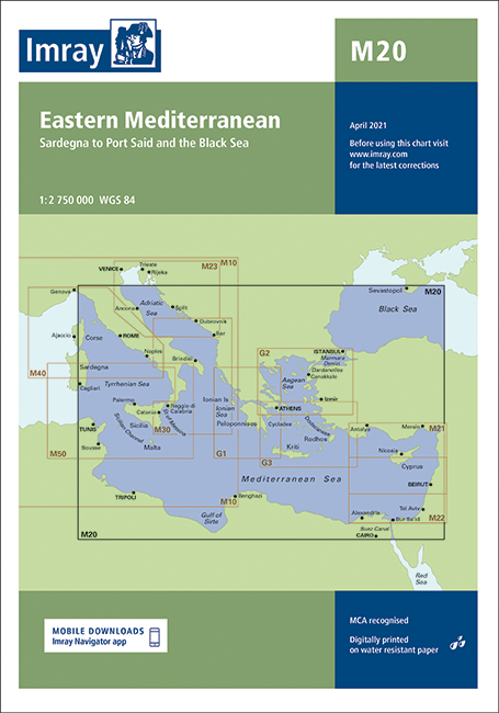
The Imray M20 Eastern Mediterranean chart offers a wide‑area view from Sardinia to Port Said and the Black Sea, making it an essential planning tool for longer cruises and delivery passages. Ideal for skippers needing a clear strategic overview.
Broad coverage: Spans the central and eastern Mediterranean, including approaches to the Aegean, Levant and Black Sea
Passage planning focus: Designed for route selection, seasonal planning and linking between more detailed Imray coastal charts
Clear presentation: Uncluttered layout highlighting major sea areas, key waypoints, traffic zones and principal ports
Versatile use: Serves as an overview chart at the table and a quick‑reference chart in the cockpit when reviewing long‑range options
Use this chart as your master planning sheet for Eastern Mediterranean and Black Sea voyages.