UK taxes included where applicable. Export prices are excluding VAT.
Shipping calculated at checkout.
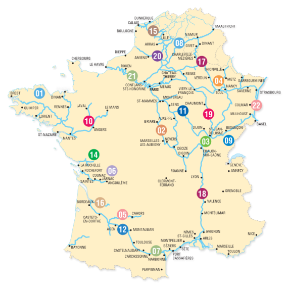
Navigable waterways of France on an overview map at 1:1,000,000 from Editions du Breil, presented on a base with relief shading and colouring for wooded areas to provide a better picture of the country’s topography.
Navigable sections of rivers and canals are classified according to their gauge (gabarit) and are annotated with information on the overall length, the number of locks with their lengths and widths, plus draught and bridge clearances. Locations at each end of a navigable part of a river or a canal are highlighted.
*Map legend is in French, English and German.* The choice of terms used in the English translation varies somewhat from those found in other similar publications and includes terms such as Freycinet gauge or dividing pound.