UK taxes included where applicable. Export prices are excluding VAT.
Shipping calculated at checkout.
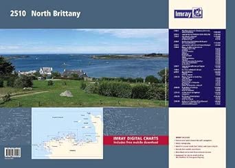
This Imray 2510 North Brittany wirobound chart pack provides detailed coverage from the Channel Islands and Cherbourg Peninsula to Ile d’Ouessant and the Rade de Brest. Developed to support demanding coastal and cross‑Channel passages.
14 A2 sheets including approach and large‑scale harbour plans for St-Malo, St-Cast, Paimpol, Treguier, Morlaix and more
WGS 84 compatible charts with latest depth surveys, tidal streams and updated tidal data
Detailed pilotage for rivers and intricate coasts: Trieux, Treguier, L’Aber Wrac’h, Brest approaches
Clear scales for passage, inshore navigation and drying harbours in complex tidal waters
Wirobound in a tough plastic wallet plus voucher for ID20 Imray digital charts in Imray Navigator
An authoritative atlas for safe navigation along the North Brittany coast.