Imray
SKU:YOT3039
Regular price
£23.95 GBP
Regular price
Sale price
£23.95 GBP
UK taxes included where applicable. Export prices are excluding VAT.
Shipping calculated at checkout.
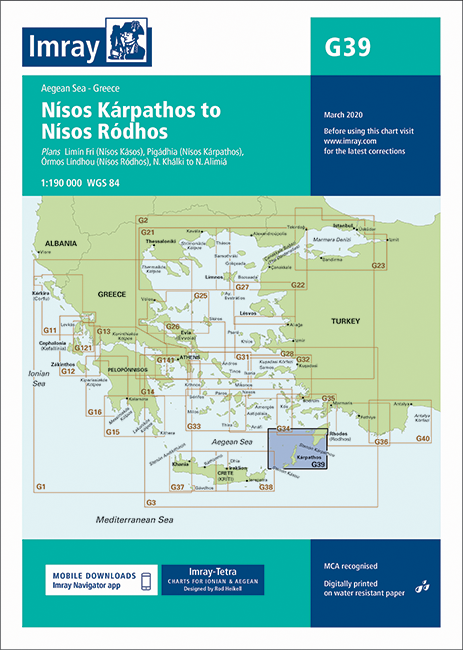
Imray G39 Nísos Kárpathos to Nísos Ródhos is a detailed nautical chart for safe passage planning in the southeastern Aegean Sea.
- Coverage: Coastal waters from Kárpathos to Ródhos, ideal for cruising sailors and yachts
- Included plans: Limni Fri (N. Kásos), Pigadhia (N. Kárpathos), Órmos Líndhou (N. Ródhos), N. Khálki to N. Alimia
- Scale and detail: Clear coastal contours, depths and aids to navigation to support accurate pilotage
- Practical use: Designed for route planning, harbour approaches and anchorage selection
A reliable reference for skippers navigating between these Dodecanese islands.
Share
View full details