1
/
of
1
Imray
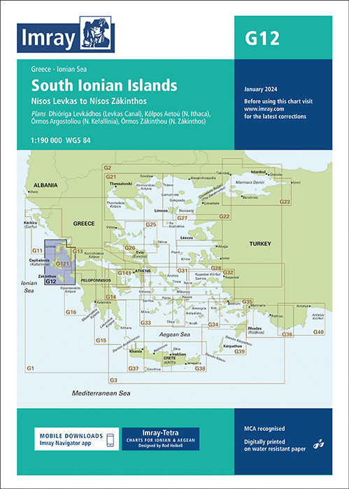
G12 South Ionian Islands (Imray Chart)
G12 South Ionian Islands (Imray Chart)
SKU:YOT3012
Regular price
£23.95 GBP
Regular price
Sale price
£23.95 GBP
UK taxes included where applicable. Export prices are excluding VAT.
Shipping calculated at checkout.
Imray G12 South Ionian Islands delivers precise coverage of one of Greece’s most frequented cruising regions, ideal for planning itineraries and close-in pilotage between the islands and mainland. It is optimised for yachts and smaller craft.
- Area coverage: South Ionian Islands with primary cruising routes and coastal detail
- Included plans: Dhióriga Levkádhos (Levkas Canal), Kólpos Aetoú (N. Ithaca), Órmos Argostolíou (N. Kefallínia) and Órmos Zákinthou (N. Zákinthos)
- Cartographic sources: Latest official hydrographic surveys combined with Imray’s on-the-water information
- Cruising detail: Marks anchorages, harbours and facilities frequently absent from official charts
- Construction quality: Water-resistant Pretex paper suited to regular cockpit handling
Pair this chart with Imray pilot guides for accurate, efficient navigation throughout the South Ionian Islands.
Share