UK taxes included where applicable. Export prices are excluding VAT.
Shipping calculated at checkout.
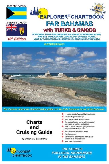
The 10th edition Explorer Chartbook – Far Bahamas with Turks & Caicos provides precise charting and cruising data from Eleuthera to the Turks and Caicos, allowing confident navigation of the outer Bahamas.
Covers Eleuthera, Cat Island, Long Island, Inagua and Turks & Caicos
Includes Tide Tables 2026
91 cruiser‑oriented charts: overview, small, medium, large scale and closeups
Detailed hydrographic and topographical information plus land road maps
On‑scene GPS waypoints, routes, shaded depth contours and 1/10‑minute grid
Printed on water‑ and tear‑resistant material for durability on board
Comprehensive Need‑to‑Know Info, marina listings and specialist articles on local cruising, formalities and services