UK taxes included where applicable. Export prices are excluding VAT.
Shipping calculated at checkout.
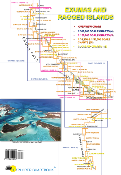
The 12th edition Explorer Chartbook – Exumas and Ragged Islands offers precise, newly redrawn charts of the central Bahamas cruising grounds, optimised for accurate piloting.
Covers the Exuma chain and Ragged Islands
66 full‑colour cruiser charts and insets, digitally redrawn from aerial photography
Tide Tables 2026–2027
Overview plus small, medium, large scale and closeup charts for detailed route planning
Extensive hydrographic and topographical features, shaded depth contours and 1/10‑minute grid
On‑scene GPS waypoints and routes with updated hydrographic data
Water‑ and tear‑resistant pages (handle wet charts gently and store out of sunlight)
Comprehensive Need‑to‑Know Info, marina tables, road maps and articles on piloting, weather, provisioning and remote‑area cruising