1
/
of
1
Imray
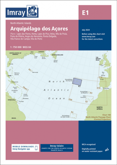
E1 Arquipelago dos Açores (Imray Chart)
E1 Arquipelago dos Açores (Imray Chart)
SKU:YOT0995
Regular price
£23.95 GBP
Regular price
Sale price
£23.95 GBP
UK taxes included where applicable. Export prices are excluding VAT.
Shipping calculated at checkout.
Imray E1 Arquipelago dos Açores is a specialist small‑craft nautical chart for the Azores, ideal for ocean voyagers and local cruisers requiring reliable, up‑to‑date coverage.
- Coverage: Key ports and anchorages including Lajes das Flores, Horta, Lajes do Pico, Velas, Vila da Praia, Praia da Vitória, Angra do Heroísmo, Ponta Delgada, Vila Franca do Campo and Vila do Porto
- Scales: Harbour plans (to 1:7 500) plus archipelago coverage for offshore approach and inter‑island routing
- Data: Latest official surveys combined with extensive Imray‑Iolaire cruising research
- Enhancements: Completed harbour works at Porto das Velas (São Jorge) and additional Marine Reserves clearly shown
- Navigation: Magnetic variation curves added for more accurate course planning
- Material: Printed on robust, water‑resistant Pretex paper suited to demanding ocean use
A comprehensive chart set for safe navigation to and within the Azores.
Share