Skip to product information
1 of 1

NV Charts

NV Atlas Germany DE 11 - Elbe - Helgoland bis Hamburg

NV Atlas Germany DE 11 - Elbe - Helgoland bis Hamburg

SKU:YOT0006DE11

Regular price £64.99 GBP
Regular price Sale price £64.99 GBP
Sale Sold out
UK taxes included where applicable. Export prices are excluding VAT. Shipping calculated at checkout.

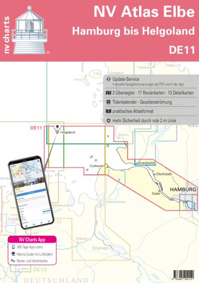
The NV Atlas Germany DE 11 covers the busy Elbe waterway from Hamburg to Helgoland, providing all essential data for safe navigation in the German Bight.

  • Coverage: Elbe from Hamburg via Wedel, Glückstadt and Brunsbüttel to Cuxhaven and offshore to Helgoland
  • Chart package: 2 oversailers, 17 cruising charts, 13 detailed harbour and lock plans
  • Tide information: Tidal calendar and current data linked to tide diamonds for accurate voyage planning
  • Format: Atlas with flat staple binding and splash‑protected cover for reliable cockpit handling
  • Digital access: 365‑day NV Charts app and navigation software licence with seasonal updates

Designed as a complete chart solution for Elbe and Helgoland approaches.

View full details
Your cart
Product Product subtotal Quantity Price Product subtotal
NV Atlas Germany DE 11 - Elbe - Helgoland bis Hamburg - Boat-Stuff
NV Atlas Germany DE 11 - Elbe - Helgoland bis HamburgYOT0006DE11
£64.99/ea
£0.00
£64.99/ea £0.00