NV Charts
SKU:YOT0006DE10
Regular price
£64.99 GBP
Regular price
Sale price
£64.99 GBP
UK taxes included where applicable. Export prices are excluding VAT.
Shipping calculated at checkout.
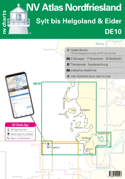
The NV Atlas Germany DE 10 is the dedicated nautical chart set for North Frisia, from Sylt and Amrum to Helgoland and the tidal Eider.
- Coverage: North Frisian Islands (Sylt, Amrum, Föhr, Pellworm, Nordstrand), Wadden Sea channels, Eider up to Lexfähre and Helgoland approach
- Chart package: 3 oversailers, 17 cruising charts, 16 detail charts plus comprehensive port plans
- Tidal data: Tide tables and current information clearly integrated in the charts for safe passage in tidal waters
- Format: Practical atlas with flat binding and splash‑protected cover for everyday onboard use
- Digital access: 365‑day NV Charts app licence with offline charts and regular updates
A robust reference atlas for coastal and estuary cruising in North Frisia.
Share
View full details