UK taxes included where applicable. Export prices are excluding VAT.
Shipping calculated at checkout.
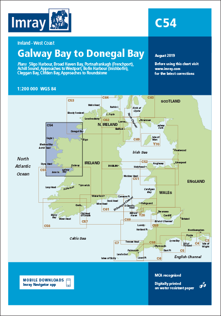
Imray C54 Galway Bay to Donegal Bay delivers comprehensive charting of Ireland’s exposed Atlantic coastline between Galway Bay and Donegal Bay for serious cruising.
Coverage: Coastal navigation from Galway Bay to Donegal Bay with clear coastal detail for offshore and inshore routes
Included plans: Sligo Harbour, Broad Haven Bay (extended to Ross Port), Portnafrankagh (Frenchport), Achill Sound, approaches to Westport, Bofin Harbour (Inishbofin), Cleggan Bay, Clifden Bay and approaches to Roundstone
Cartographic clarity: Improved specification with coloured light flashes for easier night navigation
Updated surveys: 2018 edition incorporating latest available depth data and full general updating to support safe pilotage