UK taxes included where applicable. Export prices are excluding VAT.
Shipping calculated at checkout.
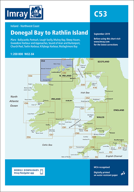
Imray C53 Donegal Bay to Rathlin Island is a professional‑grade nautical chart for navigating Ireland’s north‑west and north coasts from Donegal Bay to Rathlin Island.
Coverage: Coastal charting of the Atlantic and North Channel coasts, ideal for both passage planning and coastal cruising
Included plans: Ballycastle, Portrush, Lough Swilly, Mulroy Bay, Sheep Haven, Gweedore Harbour and Approaches, Sound of Aran and Burtonport, Church Pool, Teelin Harbour, Killybegs Harbour and Mullaghmore Bay
Night navigation: Enhanced chart specification with coloured light flashes for quick recognition of aids to navigation
Latest information: 2018 edition with updated depths from recent surveys, new plans of Ballycastle and Church Pool, plus general corrections