1
/
of
1
Imray
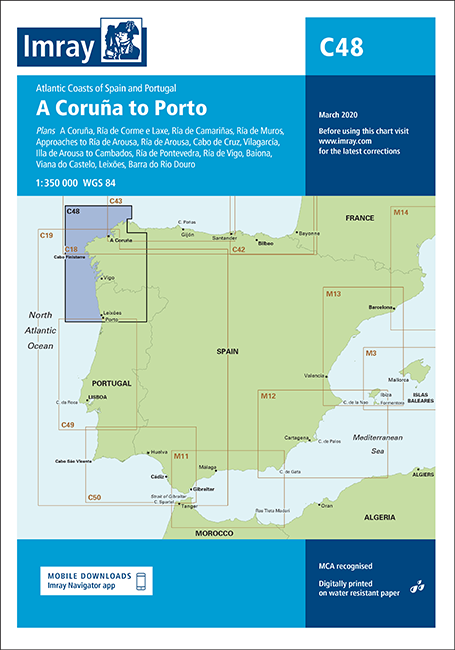
C48 A Coruña to Porto (Imray Chart)
C48 A Coruña to Porto (Imray Chart)
SKU:YOT0632
Regular price
£28.95 GBP
Regular price
Sale price
£28.95 GBP
UK taxes included where applicable. Export prices are excluding VAT.
Shipping calculated at checkout.
Imray C48 A Coruña to Porto is a comprehensive small-craft chart for the Atlantic coasts of Galicia and northern Portugal. It supports both offshore passages and detailed entry into key rías and harbours.
- Coverage: A Coruña to Porto with plans of A Coruña, Ría de Corme e Laxe, Ría de Camariñas, Ría de Muros, Approaches to Ría de Arousa, Ría de Arousa, Cabo de Cruz, Vilagarcía, Illa de Arousa to Cambados, Ría de Pontevedra, Ría de Vigo, Baiona, Viana do Castelo, Leixões and Barra do Rio Douro
- Enhanced specification: Displays coloured light flashes for improved night recognition
- Harbour developments: Numerous updates to port and marina areas across the chart
- Extended detail: Ría de Camariñas plan enlarged westward with full charting of Las Quebrantas bank
- General updates: Reflects the latest navigational and hydrographic information
An essential chart for safe cruising between A Coruña and Porto.
Share