1
/
of
1
Imray
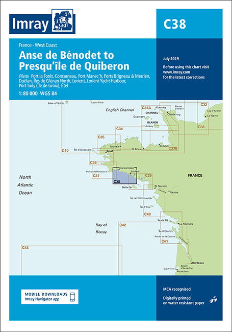
C38 Anse de Bénodet to Presqu'île de Quiberon (Imray Chart)
C38 Anse de Bénodet to Presqu'île de Quiberon (Imray Chart)
SKU:YOT0450
Regular price
£28.95 GBP
Regular price
Sale price
£28.95 GBP
UK taxes included where applicable. Export prices are excluding VAT.
Shipping calculated at checkout.
Imray chart C38 provides detailed coverage from Anse de Bénodet to Presqu'île de Quiberon, supporting precise navigation in one of Brittany’s most frequented cruising areas.
- Regional coverage: Anse de Bénodet to Presqu'île de Quiberon, including approaches to major harbours and anchorages
- Detailed plans: Port la Forêt, Concarneau, Port Manec’h, Ports Brigneau & Merrien, Doëlan, Îles de Glénan North, Lorient, Lorient Yacht Harbour, Port Tudy and Étel
- Updated edition: 2016 release with latest depth surveys applied and general updating throughout
- Harbour developments: Shows recent works at Concarneau for accurate entry, berthing and manoeuvring
- Professional specification: Clear symbols and soundings tailored to cruising yachts and small craft navigation
A practical pilotage companion for skippers operating between Bénodet, Glénan, Groix and Quiberon.
Share