UK taxes included where applicable. Export prices are excluding VAT.
Shipping calculated at checkout.
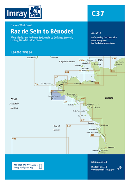
Imray chart C37 covers the coast from Raz de Sein to Bénodet, offering reliable data for navigating this exposed and tidal section of the Brittany coastline.
Coastal coverage: Raz de Sein to Bénodet, including key approaches and inshore routes
Harbour and river plans: Île de Sein, Audierne, St Guénole, Le Guilvinec, Lesconil, Loctudy, Bénodet and L’Odet Fleuve for detailed pilotage
Updated hydrography: 2017 edition with latest depth surveys incorporated where available
Improved specification: Coloured light flashes enhance clarity for night and low-visibility navigation
General updating: Revisions to aids to navigation and coastal information for current cruising use
Well-suited to cruising yachts and motorboats transiting Raz de Sein and exploring the ports and river approaches towards Bénodet.