UK taxes included where applicable. Export prices are excluding VAT.
Shipping calculated at checkout.
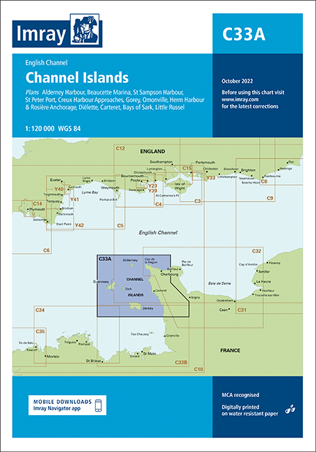
Imray Chart C33A focuses on the northern Channel Islands and adjacent French coast, providing precise information for yachts and motorboats. This small‑craft chart is fully updated for reliable navigation in tidal and rock‑strewn waters.
Coverage: Northern Channel Islands with key approaches and in‑channel routes
Harbour plans: Insets for Alderney Harbour, Beaucette Marina, St Sampson, St Peter Port and Creux Harbour approaches
Additional ports: Detailed plans for Gorey, Omonville, Diélette and Carteret to support safe entry
Anchorages: Includes Herm Harbour, Rosière Anchorage and the Bays of Sark for secure stops
Data update: Latest UKHO and SHOM information plus new bathymetric survey data integrated throughout