UK taxes included where applicable. Export prices are excluding VAT.
Shipping calculated at checkout.
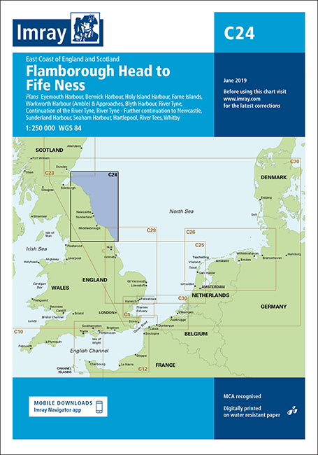
Imray Chart C24 Flamborough Head to Fife Ness is a passage chart for the east coast of England and southeast Scotland. It is designed for coastal and offshore route planning with clear, professional detail.
Scale and grid: 1:251 700 with five‑minute latitude and longitude gridlines for easy position plotting
Geographic coverage: From Flamborough Head northwards to Fife Ness, covering key cruising and commercial routes
Harbour plans: Larger‑scale insets for Holy Island, Eyemouth, Berwick, Warkworth, River Tyne, Blyth, Seaham, Sunderland, Whitby, Hartlepool, River Tees and Scarborough
Tidal information: Tidal stream diagrams support safe timing of passages along this tidal coastline
A practical planning chart for skippers transiting the east coast or entering the principal harbours on this stretch.