UK taxes included where applicable. Export prices are excluding VAT.
Shipping calculated at checkout.
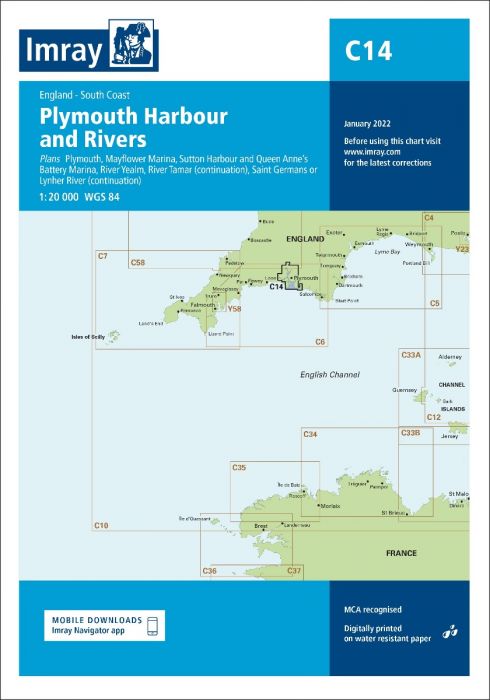
Imray C14 Plymouth Harbours & Rivers offers detailed coverage of this key West Country port and its surrounding estuaries. Optimised for small craft, it supports accurate pilotage in harbours, marinas and river approaches.
Main coverage of Plymouth Sound with detailed harbour and river information
Large‑scale plans: Plymouth, Mayflower Marina, Sutton Harbour, Queen Anne’s Battery, River Yealm, River Tamar and Saint Germans/Lynher
Incorporates the latest official bathymetric surveys for current depth information
Enhanced with Imray’s own data network for small‑craft relevance
Clear soundings, aids to navigation and shoreline detail for confident close‑quarters navigation
An essential chart for cruising, racing or based yachts around Plymouth and its rivers.