Imray
SKU:YOT0954
Regular price
£23.95 GBP
Regular price
Sale price
£23.95 GBP
UK taxes included where applicable. Export prices are excluding VAT.
Shipping calculated at checkout.
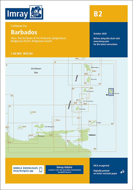
Detailed Imray chart of Barbados, designed for safe pilotage and port approaches around the island.
- Island coverage: Full coastal detail for Barbados with harbour and anchorage information
- Included plans: Port St Charles & Port Ferdinand (sketch), Speightstown (1:15 000), Bridgetown North (1:20 000), Bridgetown South (1:20 000)
- Updated content: Incorporates recent port development at Bridgetown and reschemed Port St Charles/Port Ferdinand plan
- Enhanced readability: Coloured light flashes and clear symbology
- Robust build: Printed on water‑resistant chart paper for long-term use on board
Share
View full details