Skip to product information
1 of 1

Imray

A25 St Eustatius, St Christopher, Nevis, Monserrat & Saba (Imray Chart)

A25 St Eustatius, St Christopher, Nevis, Monserrat & Saba (Imray Chart)

SKU:YOT0928

Regular price £23.95 GBP
Regular price Sale price £23.95 GBP
Sale Sold out
UK taxes included where applicable. Export prices are excluding VAT. Shipping calculated at checkout.

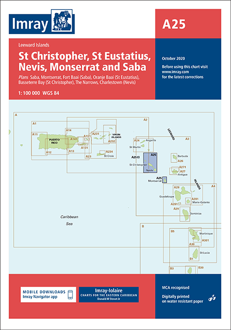
Imray nautical chart A25 covers St Eustatius, St Christopher (St Kitts), Nevis, Montserrat and Saba, providing essential detail for safe Caribbean cruising.

  • Coverage: Saba, Montserrat, St Eustatius, St Kitts and Nevis for regional route planning
  • Included plans: Fort Baai, Basseterre Bay, The Narrows, Oranjebaai and Charlestown for detailed approach work
  • Scale information: Saba I. (1:30 000) and Montserrat (1:100 000) for clear coastal navigation

A reliable planning and pilotage tool for yachts and small craft in this Lesser Antilles area.

View full details
Your cart
Product Product subtotal Quantity Price Product subtotal
A25 St Eustatius, St Christopher, Nevis, Monserrat & Saba (Imray Chart) - Boat-Stuff
A25 St Eustatius, St Christopher, Nevis, Monserrat & Saba (Imray Chart)YOT0928
£23.95/ea
£0.00
£23.95/ea £0.00