UK taxes included where applicable. Export prices are excluding VAT.
Shipping calculated at checkout.
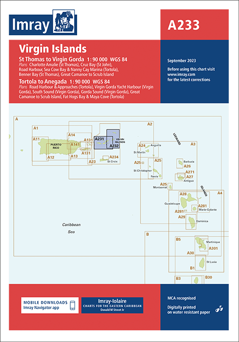
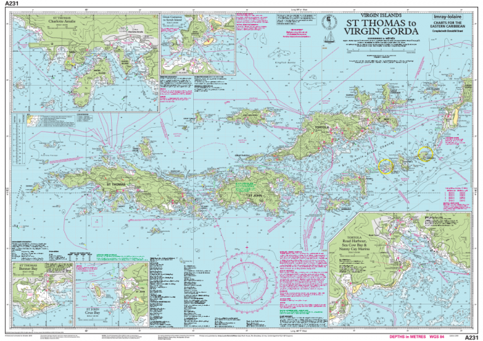
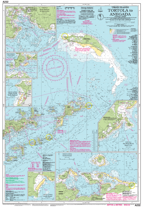
Imray A233 Virgin Islands combines A231 and A232 to deliver comprehensive coverage of the Virgin Islands for cruising sailors.
Combined coverage: Charts A231 and A232 on one sheet, printed and corrected to September 2023
Sheet format: 640 x 900 mm, waterproof Pretex paper, folded in a protective plastic wallet
Plans included: Charlotte Amalie, Cruz Bay, Road Harbour & Nanny Cay, Benner Bay, Great Camanoe to Scrub Island, Road Harbour & Approaches, Virgin Gorda Yacht Harbour, South Sound, Gorda Sound, Fat Hogs Bay & Maya Cove
Cruising focused: Shows numerous anchorages, facilities and inlets beyond many official charts
Updated data: Latest official surveys combined with over 60 years of local research from Don Street Jr and contributors
An authoritative, durable chart set designed specifically for small craft in the Virgin Islands.