1
/
of
1
Imray
Imray Chart Pack - 2510 North Brittany
Imray Chart Pack - 2510 North Brittany
SKU:YOT0861
Regular price
£59.95 GBP
Regular price
Sale price
£59.95 GBP
UK taxes included where applicable. Export prices are excluding VAT.
Shipping calculated at checkout.
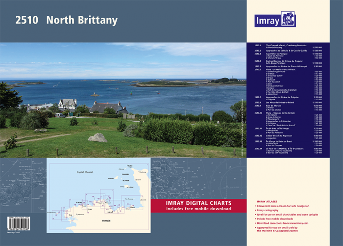
The Imray 2510 North Brittany chart pack delivers complete coverage from the Channel Islands and Cherbourg Peninsula to Île d’Oussant. Ideal for yachts and motor cruisers, it combines passage charts, detailed plans and tidal information in one structured set.
- Multi-sheet WGS 84 chart pack covering Channel Islands, St-Malo, Paimpol, Tréguier, Morlaix, Île de Batz and approaches to Brest
- Includes large-scale harbour and river plans for key ports such as St-Malo, Lézardrieux, Paimpol and Morlaix
- Updated with latest depth surveys, tidal data and tidal stream page for accurate pilotage
- Features harbour, marina and coastguard contact details for operational planning
- Supplied in convenient A2 format, suitable for use at the chart table onboard
- Includes voucher for free Imray digital charts in the Imray Navigator app
Use this professional North Brittany atlas for precise passage making and safe inshore navigation.
Share