UK taxes included where applicable. Export prices are excluding VAT.
Shipping calculated at checkout.
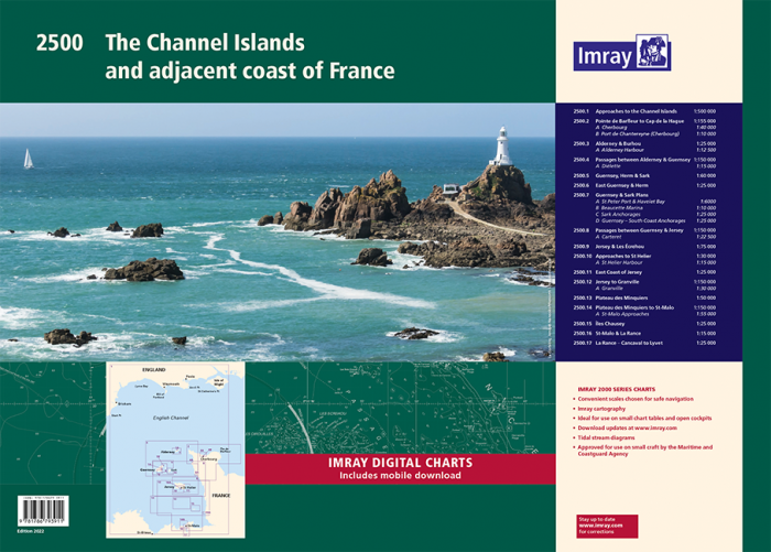
Navigate the Channel Islands and adjacent French coast with confidence using the Imray 2500 chart pack, a compact A2 atlas covering approaches, passages and detailed harbour plans.
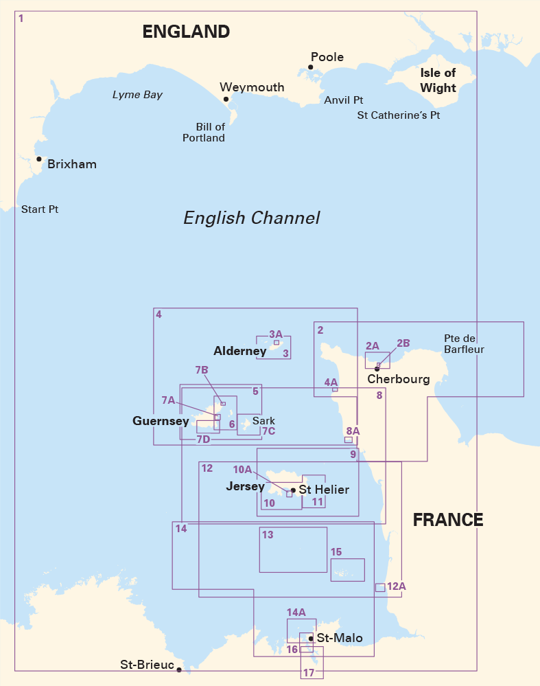
Full regional coverage: 17 sheets from Cap Barfleur to St-Malo, Jersey, Guernsey, Sark, Alderney and offshore plateaux
Passage and pilotage: small- and large-scale charts for open-water routes and tight inshore navigation
Detailed port plans: clear layouts for Cherbourg, St Peter Port, St Helier, Granville, St-Malo and La Rance
Designed for yachts and motorboats: scales optimised for small craft cruising and tidal waters
An authoritative chart pack for cruising, race support and cross-Channel planning.