UK taxes included where applicable. Export prices are excluding VAT.
Shipping calculated at checkout.
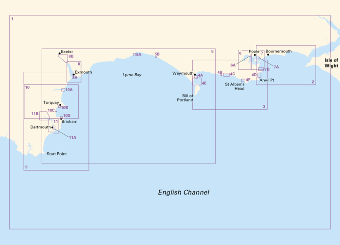
Plan safe, confident passages along the Dorset and Devon coasts with the Imray 2300 A2 chart pack, covering the River Dart to the western Solent approaches in a durable plastic wallet.
Comprehensive coastal coverage: 13 sheets from Isle of Wight to Start Point for passage, approach and harbour entry
Ideal for small craft: based on latest UKHO data plus local Imray information for inshore detail
Harbour and anchorage plans: detailed inserts for key ports, coves and bays across Dorset and Devon
Tidal information included: supports planning for streams, heights and critical tidal gates
App integration: voucher to download ID20 English Channel charts into the Imray Navigator app
Use alongside The Shell Channel Pilot for a complete pilotage and chart solution.